GaugeStage
GaugeStage - River and Lake level monitoring built for boaters and anglers.
GaugeStage - Know the Water Before You Go
Know the water before you go. Track real-time water levels across 12,000+ rivers, streams, and creeks nationwide so you can boat, fish, and plan with confidence.
Find any gauge instantly with Map View, get flood alerts, and monitor changing conditions in seconds.
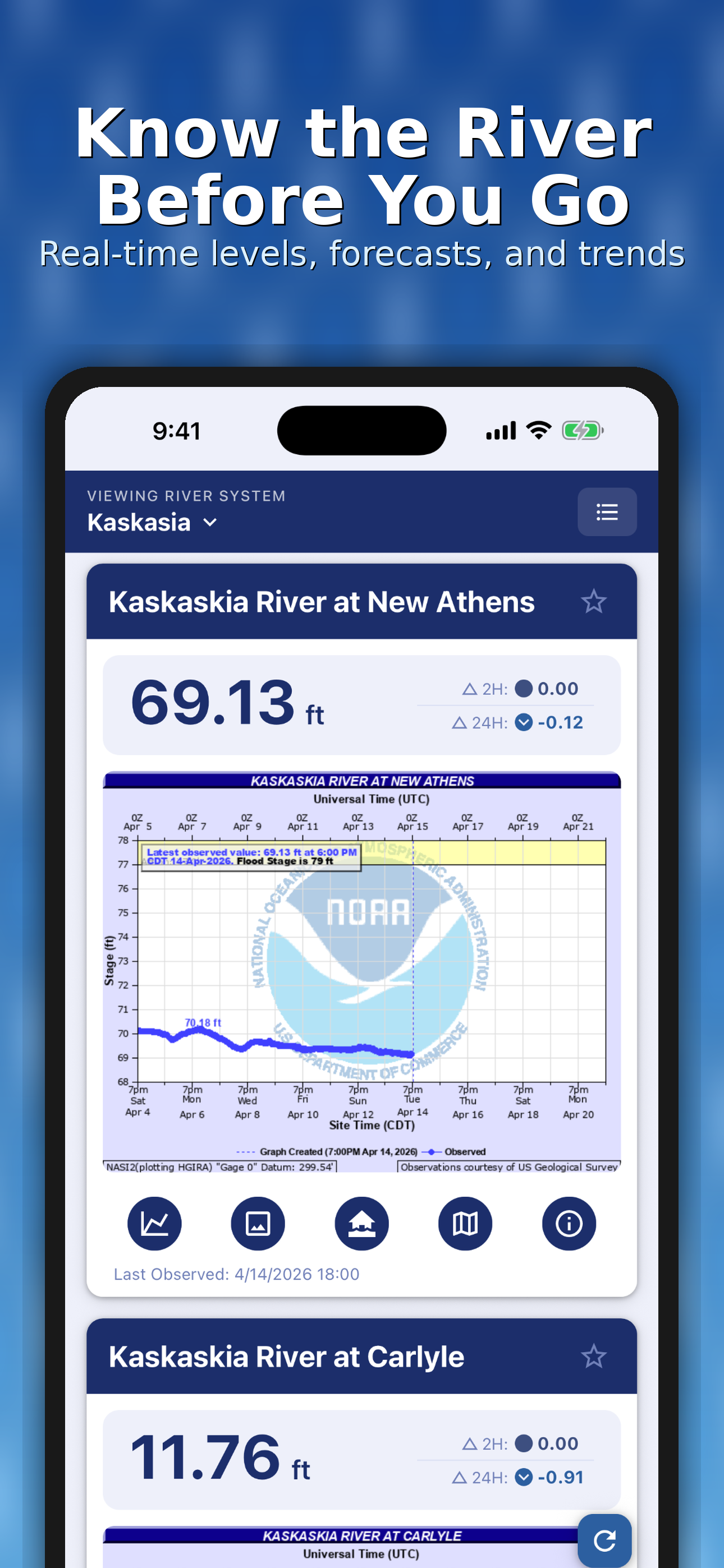
Real-Time Water Conditions Across the United States
GaugeStage provides fast, reliable access to real-time water levels, river stages, and flood conditions from over 12,000 NOAA-monitored gauges across the U.S.
Whether you’re checking river levels before launching, tracking fishing conditions, or monitoring rising water near your home, GaugeStage helps you stay informed and prepared.
GaugeStage is designed for:
- Anglers tracking fishing conditions, water levels, and current changes
- Boaters and captains planning safe navigation and river travel
- Riverfront homeowners monitoring rising water and flood risk
- Marina operators and professionals managing daily conditions
- Anyone who lives, works, or plays near rivers, lakes, streams, or creeks
Screenshots